
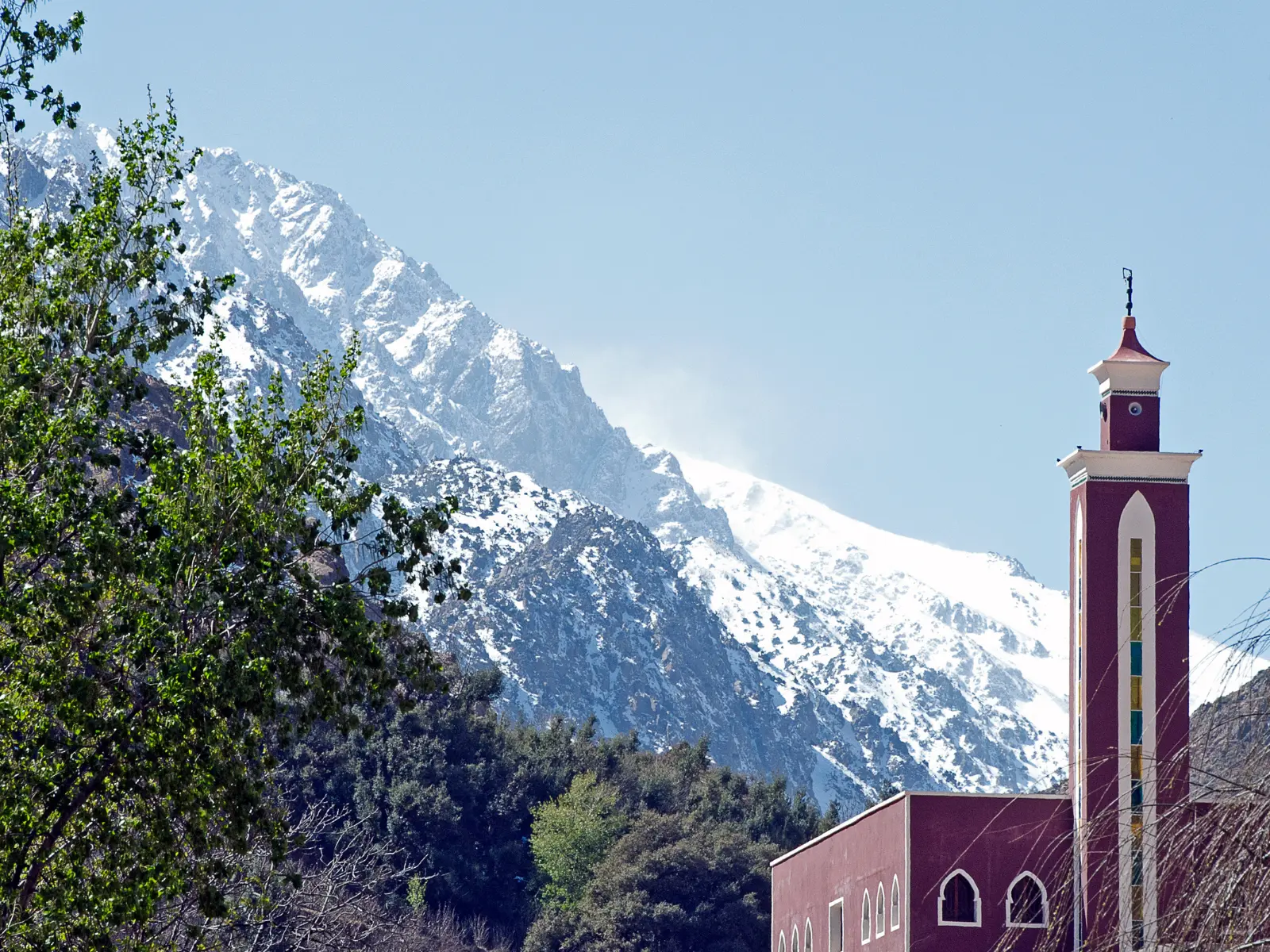
Most people see the Atlas Mountains Morocco as sand and souks. Then they drive an hour out of Marrakech, the road starts to climb, and the horizon fills with snow-topped peaks. The Atlas Mountains are the backbone of the country. They shape its climate, feed its rivers, and shelter communities whose way of life is older than the Moroccan state itself.
Where are the Atlas Mountains in Morocco? They cut diagonally across the country from the Atlantic coast in the southwest toward the Algerian border in the northeast, separating the green lowlands of the north and west from the Sahara. The Atlas mountain range as a whole stretches roughly 2,500 kilometers across Morocco, Algeria, and Tunisia, but Morocco holds its highest and most dramatic sections. That is why you can stand in a snowfield and see desert haze on the same day.
The mountains in Morocco are often lumped together, but the Atlas Mountains Morocco is famous for are really three connected ranges.
The High Atlas Mountains are the showpiece. They run through the center of the country, directly south of Marrakech, with dozens of peaks above 3,000 meters and deep valleys terraced with barley, walnuts, and apple orchards. This is where the best hiking and the best-known villages are.
The Middle Atlas, to the north and northeast, is greener and gentler. It has cedar forests, high plateaus, and small lakes, and it is home to Barbary macaques. The town of Ifrane, with its Alpine-style roofs, is nicknamed “Little Switzerland.”
The Anti-Atlas lies in the southwest, facing the Sahara’s edge. Anyone looking for the Anti Atlas mountain range should expect something quieter and older: rust-red granite and volcanic rock, pink-tinted boulders around Tafraoute, saffron fields near Taliouine, and Jbel Sirwa, an extinct volcano rising to about 3,300 meters. It sees far fewer visitors than the High Atlas.
Ask which Atlas Mountains mountains are worth knowing and a few names come up again and again. Toubkal, at 4,167 meters, is the highest Atlas peak and the highest mountain in North Africa, standing in Toubkal National Park south of Marrakech. Mgoun, at 4,071 meters, is reached by a longer, wilder trek through the Ait Bouguemez valley, sometimes called the “Happy Valley.” Jbel Sirwa dominates the Anti-Atlas, and Jbel Bou Naceur is a scenic summit in the eastern Middle Atlas that few travelers reach.
Toubkal is more approachable than its height suggests. In summer it is a steep walk rather than a technical climb, which is why it draws so many first-time trekkers.
Imlil village sits at about 1,700 to 1,800 meters, roughly 60 kilometers south of Marrakech, and it is the standard starting point for Toubkal. Imlil, Morocco, is a real mountain settlement of stone-and-mud houses, walnut trees, and a handful of guesthouses and trekking shops where you can arrange guides and mules, yet it is easy to reach by taxi or organized transfer from Marrakech. The road ends at the head of the valley and the trails begin.
Most Imlil Atlas Mountains itineraries follow the same pattern. Some travelers climb Toubkal over two days, some walk to nearby hamlets like Aremd and Tamatert, and others visit the shrine settlement of Sidi Chamharouch or simply spend a night in a guesthouse and hike out the next morning. The Atlas Mountains Imlil trailhead works equally well for a gentle valley stroll or a serious summit push.
When it comes to hiking in Morocco, Atlas Mountains routes offer more variety than almost anywhere in North Africa. The classic Toubkal ascent takes two days. On day one you walk five to six hours from Imlil to the Toubkal refuge at about 3,200 meters. On day two you start early for the summit, which takes three to four hours, then descend to Imlil. Strong hikers can do it in a single very long day, but the two-day version is more enjoyable and gives you time to adjust to the altitude.
For longer adventures, the Mgoun traverse, the Lakes of Ifni, and Jbel Sirwa in the Anti-Atlas reward trekkers with fewer crowds.
The best seasons are April to June and September to October, when temperatures are pleasant and skies are clear. In winter, Toubkal needs crampons, an ice axe, and mountain experience, and snow can close the trail. July and August bring heat in the lower valleys and occasional afternoon storms. Whatever the season, hire a local guide for higher routes, pack layers and sturdy boots, book refuge beds ahead in busy periods, and check current trail and road conditions before you go.
Could you do a day trip to the Atlas Mountains? Yes, and it is one of the easiest mountain escapes in Africa, because Marrakech sits so close to the High Atlas. The most popular options are:
A day trip will not get you to the top of Toubkal unless you are exceptionally fit and leave before dawn, but it will give you the views, the villages, and the feel of the mountains.
Who lives in the Atlas Mountains? Mainly Amazigh (Berber) communities, the indigenous people of North Africa. They speak Amazigh languages, chiefly Tashelhit in the western High Atlas and Anti-Atlas and Central Atlas Tamazight farther east.
Life here has traditionally revolved around terraced farming of barley, maize, walnuts, almonds, and apples, watered by snowmelt channels, and around herding goats, sheep, and mules, sometimes moving between summer pastures and winter valleys. Today many families also earn a living from guiding and guesthouse hospitality, especially around Imlil, and from craft cooperatives producing carpets, saffron, and argan oil. Hospitality is central to the culture, and an invitation to mint tea is often the highlight of a trip.
The region also faces real challenges. The magnitude 6.8 earthquake of September 2023 struck the High Atlas and severely affected many villages, including in the Imlil area. Reconstruction has been ongoing and conditions vary from village to village, so it is worth checking current information before you plan a visit.
The Atlas Mountains are not a single destination but a whole world: cedar forests in the north, snowy 4,000-meter peaks in the center, and volcanic, rust-colored country in the southwest. Whether you take a half-day drive from Marrakech, climb Toubkal from Imlil, or wander the quiet Anti-Atlas, the mountains show a side of Morocco that many visitors never see.
If you meant something different by “in text,” tell me which keywords you’d like handled differently. I can also apply the same treatment to the desert and Ceuta articles, or build the SEO package for this one.